ISSN 1973-9702

Call for Photos

Iranian Urbanization

edited by Alessandro Coppola and Arman Fadaei


The scientific journal QU3 – iQuaderni di UrbanisticaTre (issn 2531-7091) is looking for a  Photographic project to complement its issue no.17, edited by Alessandro Coppola and Arman Fadaei, Iranian Urbanization.


1. Subject of the Photographic project:

For the new issue on Iranian cities, we are looking for photo contributions that would accompany a set of selected articles. The focus of the issue is on different aspects of Iranian urbanization under rapid and continuous socio-economic alterations in past several decades. However, the images should be supposedly representative of Iranian cities in a broader way. They could portray urbanization processes, territory, infrastructure, housing projects and urban societies as an overarching term. QU3 is looking for professional photos, stories, collections, photomontages, etc. that could fit this issue. 

2. How to participate 

Everyone can participate sending a photographic project and a description following these indications:

A. Photographic project

1. The pictures must be in a digital version

2. The Photographic project must include between 8 and 20 pictures 

3. The pictures must be an original work of the author 

4. The pictures’ content must not infringe any intellectual property

5. Pictures’ dimensions: short side 20 cm

6. Resolution: 300 dpi

7. File dimension: max 6 Mb (per picture)

8. Format: .jpg

9. All files must be named with the authors’ name followed by the work’s title and a possible caption 

(e. g. ‘JohnSmith.roma.pantheon.jpeg’)

B. Description (.doc; .docx format)

1. Author’s name and surname

2. Title of the Photographic Project 

3. Description of the photographic project (max 1500 characters, including spaces)

4. Author’s bio (max. 700 characters, including spaces)

The project and description must be sent to the e-mail address urbanisticatre@gmail.com no later than July 31st. The e-mail subject must be the following: CALL FOR PHOTOS_QU3-17_Surname. Title of the photographic project (e.g.: CALL FOR PHOTOS_QU3-17_Smith. Pantheon).

In case the attachments are too big to be sent via e-mail, it is possible to use WeTransfer (https://wetransfer.com ) to send both the photographic project and the description.

3. Selection criteria:

QU3 will select the most suitable photographic project according to the following criteria: 

A. Adherence to the topic; 

B. Composition; 

C. Description of the project. 

Authors are requested to bear the graphic setting of QU3 in mind when preparing the pictures. 

4. Publication:

The photographic project will be published in its own section of the journal. The editorial board of QU3 will choose which and how many pictures will be published in the issue. 

The editorial board of QU3 will also choose one of the pictures of the selected photographic project to be the cover picture of the issue (the picture will have to be resized and cropped in order to adapt it to the journal’s format). 

In case none of the materials received satisfied the criteria listed above, the editors and the editorial board of QU3 reserve the right of proceeding using different methods to select the photographic project.

5. Deadline 

Materials must be submitted by July 31st 2018

6. Non-exclusive distribution license 

By sending the material the author hereby declares to QU3 – iQuaderni di UrbanisticaTre (issn 2531-7091): 

to be its author, with the entitlement to grant the rights included in this license;

that the material, unless otherwise specified, is the author’s original work and that the author is entitled to grant the rights included in this license; 

that the material, as far as it has been possible to ascertain, is not infringing any third-party copyright. In case the author does not have the copyright of some parties, they declare to have obtained from the legitimate holder of the copyright a non-restrictive authorization to grant QU3 – iQuaderni di Urbanistica Tre the rights requested by this license and that such third-party material is clearly identified and recognizable within the work. 

Likewise the author grants QU3 – iQuaderni di UrbanisticaTre (issn 2531-7091):

the non-exclusive right to distribute the materials through the publication of the journal and through its website http://www.urbanisticatre.uniroma3.it/dipsu/ and to allow the users to reproduce and distribute it with any means and format as long as authorship is acknowledged;

the right of archiving, reproducing and transferring the materials on any medium and format for reasons of security, backup and conservation and in order to maintain its accessibility in time, without modifying its content. If the sent materials are based on a work sponsored or supported by an entity or organization, the author declares to have fulfilled all duties imposed by contracts or agreements stipulated with such entities or organizations. 

QU3 – iQuaderni di UrbanisticaTre (issn 2531-7091) and the editors will clearly identify the name of the author or of the holder of the rights on the sent materials and will not modify them in any way, with the exception of what is permitted by this license.

7. Questions? 

For further information, please send an e-mail to urbanisticatre@gmail.com.

Here you can download the Call for Photos_s!

PUBLIC PARTICIPATION AND TERRITORY DEVELOPMENT


Public Participation and Territory Development. Using Localism to face Globalization.

di Nuno Bigotte Santos


Globalization is leading to a growing standardization of products, economic, social and even cultural processes (we could call it a “global acculturation” or, as I usually refer to it, the “globalizing standardization”). The only way to respond to these phenomena is, as a paradox, developing localism as a response to globalization, integrating it, in order to defend local traditions and culture, that is, the cultural and social identity of each population/ village. Therefore, the question of public participation is becoming much more important, as a mean to foster that localism. This dichotomy between Local vs. Global has been studied over the last decades by several authors. In this article I focus my attention on the contributions by Phillip Cooke, Robert Putnam, Patsy Healey and Doreen Massey.


Nuno Bigotte Santos has an Economics Degree and a Master Degree in Spatial Planning, Innovation and Development Policies. His academic studies and professional experience focus on the idea of Optimization: of processes and resources, but also of behaviours, in a company environment as well as in a territorial governance point of view.
Lately, he has been collaborating with the Northern Regional Authority of Portugal, analysing investment projects within the EU funds, but also he is a member of the Urbanism and Architecture Studies Centre in the Faculty of Architecture of the University of Porto, collaborating in different projects related with spatial planning.

Novità in rubriche – Focus

PAESAGGI DI RACCORDO


Paesaggi di Raccordo. Nuove trame di spazi aperti tra Anagnina e Torre Spaccata

di Giulia Marino


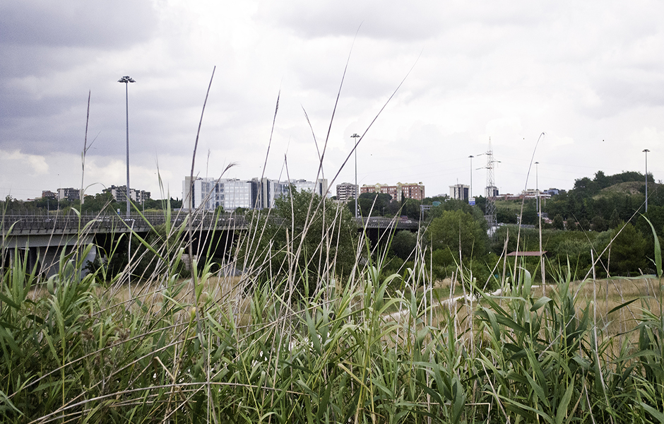
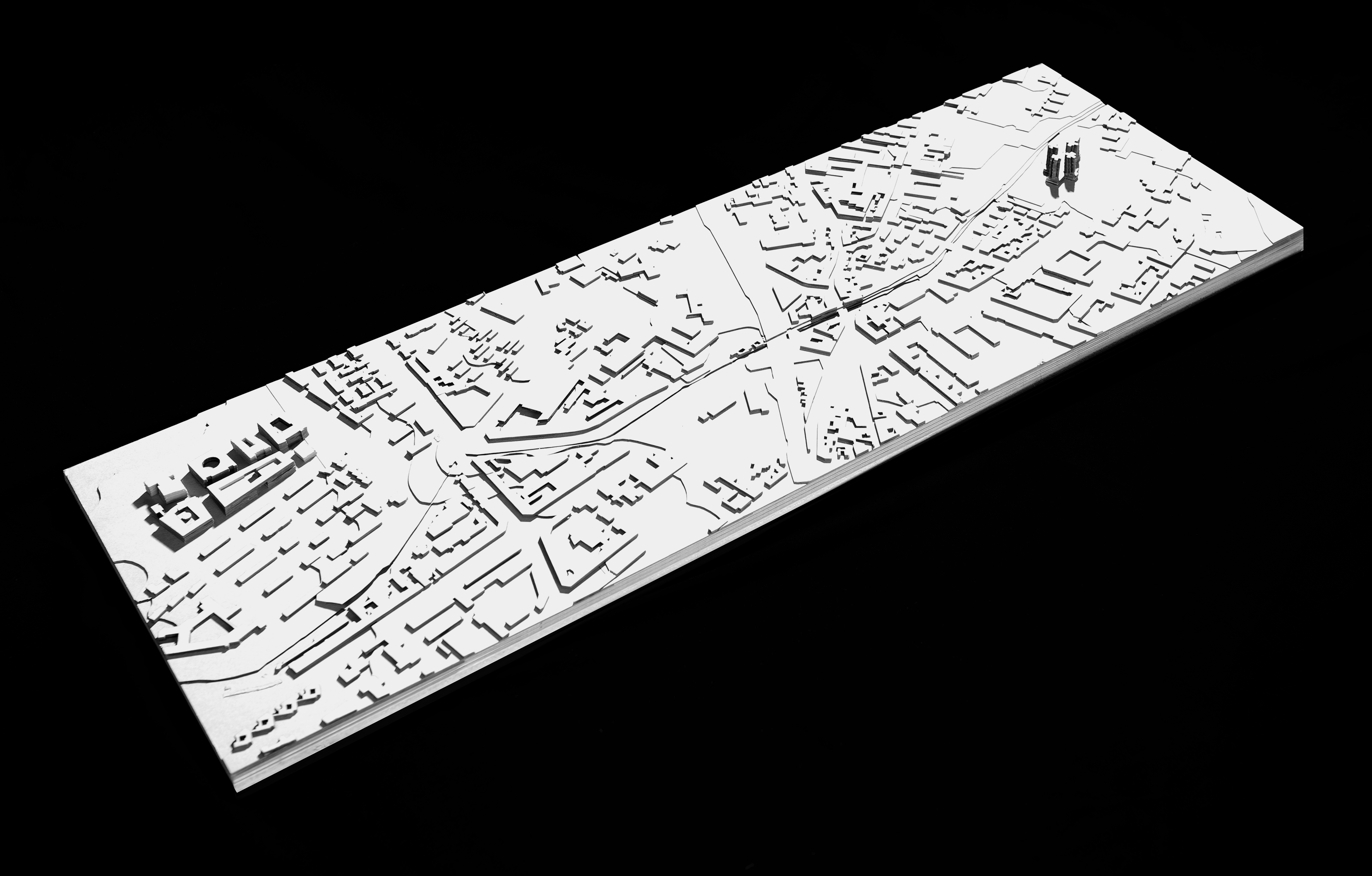
La ricerca riguarda le discontinuità materiali e immateriali delle parti di città che gravitano attorno al GRA. L’area di studio, a sud-est di Roma, è l’esito della giustapposizione di pezzieterogenei, introversi, autonomi e separati da vuoti, dove né la trama del costruito né quella infrastrutturale risolvono la questione complessa dei rapporti tra le parti.
È possibile individuare proprio nel sistema dei vuotila figura in grado di determinare, supportare e potenziare rapporti di carattere funzionale, narrativo e ambientale tra le parti? Può questa figura diventare ossatura e principio di orientamento, senza perdere la varietà di condizioni al suo interno? È possibile volgere le porzioni di “strato libero” in un sistema continuo, capillare e coesivo? La strategia di progetto individua nei Paesaggi di Raccordo– paesaggi ibridi i cui valori da preservare sono la continuità e la capacità di insinuarsi nella materia urbana esistente – la trama ri-strutturante di questa parte di città.

The research is about material and immaterial discontinuities in those parts of the city that surround the GRA. The selected area, in Rome, is the result of a juxtaposition of piecesthat are heterogeneous, introverted, autonomous and divided by empty spaces, where neither the urban fabric nor the system of the infrastructures can solve the complex matter of relationships among the parts. Is it possible to identify inthe system of the voidsthe figure that is able to determine, to support and to enhance the relations (functional, narrative and environmental) among the parts? Can this figure become the backbone and the guiding principle, without losing its variety of conditions? Is it possible to turn the “empty layer” into a continuous, capillary and cohesive system? The strategy identifies Paesaggi di Raccordo- hybrid landscapes whose values to be preserved are the continuity and the ability to seep in the existing urban fabric – as the plot able to reorganize this part of the city.

Giulia Marino si è laureata con lode in Progettazione Urbana presso l’Università di Roma Tre, nell’ambito del Laboratorio di Laurea “Attraverso il GRA. Progetti per la città anulare”, con una tesi dal titolo “Paesaggi di Raccordo. Nuove trame di spazi aperti tra Anagnina e Torre Spaccata”. Ha svolto attività di supporto didattico nei corsi “Fondamenti di Architettura del Paesaggio” e “Territorio, Ambiente e Paesaggio” presso il Dipartimento di Architettura di Roma Tre. Ha collaborato con lo studio ATELYE 70 Planning and Design a Istanbul (2016) e con RUR – Rete Urbana delle Rappresentanze a Roma (2017).

11


di Fulvio Orsenigo


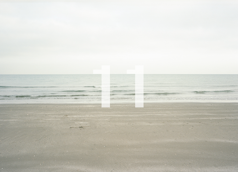
Questa serie di fotografie si propone di esplorare la relazione esistente tra l’aspetto formale delle immagini e la struttura sensibile dell’organo biologico. Questa relazione viene indagata attraverso un graduale svuotamento degli aspetti emozionali ed occasionali contenuti nelle immagini,  regredendo nel processo percettivo dall’oggetto alla struttura, all’elemento singolo percepito come regolarità geometrica nel campo visivo. In questo processo di regressione gli aspetti formali che ne emergono non sono più qualità geometriche o di luminanza rappresentate negli oggetti, ma piuttosto qualità rappresentate nelle operazioni della struttura primaria dell’analizzatore sensoriale il cui prodotto, l’immagine, non è più immagine di qualcosa, ma manifestazione di quelle operazioni. Le fotografie di11inseguono questa regressione: è il tentativo di leggere l’immagine come architettura della struttura primaria, evidenziando le costanti implicite che operano nella relazione tra organo di senso e ambiente, costanti che sono di fatto trasparenti, inglobate e infine incarnate negli oggetti della percezione.

This series of photographs aims to explore the relationship between the formal aspect of the images and the sensitive structure of the biological organ. This relationship is investigated through a gradual emptying of the emotional and occasional aspects contained in the images, regressing in the perceptual process from the object to the structure, to the single element perceived as geometric regularity in the visual field. In this regression process, the formal aspects that emerge are no longer geometric or luminance qualities represented in the objects, but rather qualities represented in the operations of the primary structure of the sensory analyzer, whose product, the image, is no longer the image of something, but the manifestation of those operations. The photographs of 11 follow this regression: it is an attempt to read the image as architecture of the primary structure, highlighting the implicit constants that operate in the relationship between sense organ and environment, constants that are in fact transparent, incorporated and finally embodied in the objects of perception.

Fulvio Orsenigo è un fotografo di architettura e di paesaggio. Al centro del suo lavoro è il rapporto tra rappresentazione spaziale e processi percettivi, che viene esplorato nei progetti sull’architettura e sul paesaggio. Ha ideato e partecipato al progetto collettivo Venezia_Marghera, curato da Paolo Costantini ed esposto in occasione della 47 Biennale di Venezia (1997). Ha pubblicato, con Alessandra Chemollo, i volumi “Senzaposa” (2004) e “Internofuori” (2006). Dal 2005 al 2009 insegna fotografia all’Università di Architettura di Venezia. Cofondatore di Fuorivista, un collettivo di fotografi con il quale produce e cura il progetto e il libro “Sismycity. L’Aquila 2010” (2010), un lavoro sugli effetti del terremoto dell’Aquila, esposto a Palazzo Ducale di Venezia e alla Triennale di Milano. Nel 2016 è invitato ad esporre “Italogramma”, un progetto con Alessandra Chemollo, nel Padiglione Italia della 15. Biennale di Architettura. Le sue fotografie sono ampiamente pubblicate in riviste e libri di architettura.

GREEN WAY TERZOLLE


Green Way Terzolle. Un sistema d’interventi per disegnare il paesaggio

di Giacomo Dallatorre


I corsi d’acqua rappresentano elementi di continuità attraverso i quali ripensare le periferie dei centri abitati, affidandosi ad un processo di ricucitura dei margini e di messa a sistema dei vuoti urbani. Segnalato nel Piano Strutturale come uno dei principali corridoi ecologici del Comune di Firenze, il Terzolle è la spina dorsale della proposta per un parco lineare tra i quartieri di Novoli e Rifredi. Si prevede il riutilizzo di questa antica infrastruttura urbana in un nuovo scenario: il bordo del torrente può essere vissuto in maniera continua, attraverso il risanamento dei sistemi di accesso esistenti ed un abaco di progetti lungo il percorso, in grado di rinnovare il rapporto tra natura e città. Il parco si struttura attraverso una serie di stanze all’aperto dove sostare lontani dai rumori del traffico. Il passaggio tra le sponde è garantito dal recupero dei ponti esistenti e la previsione di nuove pergole, mentre un sistema modulare di padiglioni ospita servizi legati allo sport ed attività per la vita di quartiere.

Watercourses represent continuity elements through which reconsider the suburbs of built-up areas relying on a process to reconnect the river sides and to organize in a system a series of urban empty spaces. Reported in the Structural Plan as one of the main ecological corridors of Florence Municipality, Terzolle is the backbone of a proposal meant to create a line park between the neighborhoods of Novoli and Rifredi. It is expected the reuse of this ancient urban infrastructure set in a new scenario: the edge of the stream can be experienced continuously, through the requalification of the existing entry systems and an abacus of projects along the way able to revive the relation between nature and city. The park is structured through a series of open rooms where to stand away from the traffic noise. The passage between the shores is guaranteed by the recovery of existing bridges and the plan of new pergolas, while there’s a modular system of pavilions hosting services connected to sport and activities for the neighbourhood life.

Giacomo Dallatorre (Montevarchi, 1986), è architetto e borsista di ricerca. Dopo la laurea presso l’Università degli Studi di Firenze (A.I. Volpe, Fabio Lucchesi, 2012), è cultore della materia presso il laboratorio dell’architettura III, prof. Andrea Innocenzo Volpe. È attualmente collaboratore del Dida Communication Lab, afferente al sistema dei laboratori DIDALABS, con il quale partecipa a numerosi progetti editoriali e di ricerca. In qualità di tutor partecipa a numerosi workshop ed allestimenti, tra i quali: “Camaiore and the Via Francigena” (2017, supervisor prof. Toru Ajisaka e Makiko Masudome), “Prato (China) Crossing new zeland” (2013, supervisor Prof. Francesco Collotti, Prof. Tony Van Raat.

Barcellona e il diritto alla città


di Juana Furió


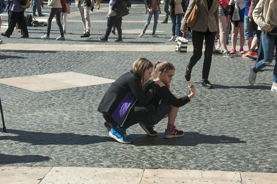
Dal 1850 la trasformazione urbana di Barcellona è stata legata a una serie di grandi eventi internazionali che funsero da biglietto da visita per entrare a far parte della costellazione di città moderne, così come per colmare le carenze di pianificazione e servizi destinati a una popolazione in costante crescita. Nel corso degli anni le inversioni pubblico-privato hanno stabilito una dinamica di rafforzamento reciproco sia per i grandi progetti sia per quelli “chirurgici” di minore rilievo che, dal 1986, hanno risanato zone emarginate al fine di renderle più sicure e attraenti per i loro abitanti. L’eliminazione delle vecchie leggi degli affitti che proteggevano i locatari ai fini di fare della casa un bene di mercato, insieme al richiamo al capitale estero per sostituire gli investimenti pubblici sono stati considerati un fattore di diseguaglianza e rientrano nel fenomeno della gentrificazione. I movimenti sociali contro l’esclusione e per il diritto a un alloggio decente aumentano in proporzione al numero di quartieri colpiti dalla mutazione di Barcellona in città di vacanze dove i residenti sono espulsi dai loro appartamenti in affitto che saranno trasformati in alberghi e appartamenti turistici. Questo è il momento chiave per pensare al diritto alla città e ai doveri delle autorità di proteggerlo e garantirlo davanti i flussi finanziari che rifiutano qualsiasi controllo.

Since 1850 Barcelona’s urban transformation has been linked to big international events to be used as a calling card so as to count among the constellation of modern cities and to correct planning and services deficiencies for a constantly growing population. Along the time public and private investments stablished a mutually- reinforcing dynamic both for big projects and for minor “chirurgical” interventions, which, since 1986, cleaned up marginalized areas to become safer and attractive to their inhabitants. The removal of laws protecting tenants to make housing a market asset together with the appeal to foreign capital to replace public investments has been considered a factor of inequality, encompassed within the global phenomenon of gentrification. Social movements against exclusion and for the right to decent housing increased proportionally to the growing number of neighborhoods affected by Barcelona’s switchover in a holiday town where residents are expelled from their rented houses due to their conversion into hotels or turistic appartments. This is the key moment to think about the Right to the City and public authorities’ duty to protect and guarantee it in front of blind financial flows that reject any control.

Juana Furió nasce a Valencia (Spagna) nel 1962. Consegue la laurea in Filologia romanica nel 1987 presso l’Università di Barcellona; nel 1995 consegue il Dottorato in giornalismo presso l’Università autonoma di Bellaterra e nel 2017 ottiene un Master in Fotogiornalismo presso la Mittuniversitetet di Sundsvall (Svezia). Dal 1987 documenta fotograficamente la trasformazione urbana di Barcellona.

LA MINIERA DI SALGEMMA DI LOULÉ


La miniera di salgemma di Loulé nel paesaggio del Portogallo meridionale: una risorsa a livello paesaggistico e urbano.

di Daniele Stefàno


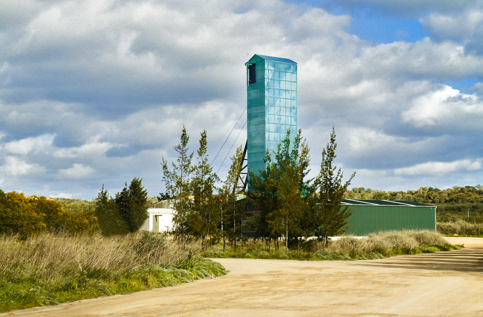
Le miniere sono generalmente degli spazi chiusi, ma custodiscono molte qualità, che se considerate alla luce di una possibile riqualificazione urbana offrono nuovi e interessanti punti di vista. La miniera di sale di Loulé (Algarve, Portogallo) è profonda duecento metri, e si articola in tunnel sotterranei giustapposti alla maglia urbana superficiale. L’articolo vuole mostrare le potenzialità della miniera di Loulé, considerandola nel suo contesto paesaggistico e territoriale ponendo l’accento sui possibili utilizzi dell’area mineraria, sottolineando come possa rappresentare un esempio per la riqualificazione delle miniere e come questi spazi marginali possano riconnettersi ecologicamente ai sistemi esistenti. La ricerca si basa sul concetto di interpretare il sottosuolo come un centro di energie che portano in superficie dei risultati a livello urbano e paesaggistico; un organismo vivo che agisce e reagisce, di produzione di benessere e cultura.

Loulé is a famous town in the Algarve region, in southern Portugal and his salt mine is considerably large, made by a vast grid of tunnels underground. Mines are generally not a visible source, but they have many qualities that can help in urban and landscape planning. The article aims to show the potential role of the mine in a landscape requalification, and what the other functionalities can be at the end of the salt production. The Loulé salt mine is also a relevant example of how mines can interact with the city sustainably. According to that, abandoned areas can be opened to the public and integrated into the ecological and urban system. Moreover, the research highlights the advantages of the Loulé mine as an essential part of the city and the landscape.

Daniele Stefàno, nato a Roma nel 1991, si è laureato in Architettura del Paesaggio presso l’Università degli Studi di Roma “La Sapienza” nell’a.a. 2016-17 e nell’a.a. 2017-18 ha conseguito il Master di II livello in Paesaggistica presso l’Università degli Studi di Firenze. A Lisbona ha potuto approfondire la progettazione del paesaggio presso Instituto Superior de Agronomia con João Nunes. Nel contempo,ha realizzato un giardino temporaneo per Giardineggiare nel 2013, presso la Biennale del Giardino Mediterraneo di Grottammare. Attualmenteè Segretario della Società Scientifica Italiana di Architettura del Paesaggioe collabora a ricerche dello IUVAS – Institute for Urban Variation and Architectural Systems.